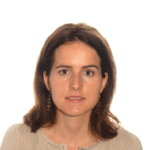
Imma Serra Recasens
I studied Technical Engineering in Topography at the Universitat Politècnica de Catalunya and later Engineering in Geodesy and Cartography at the Universitat Politècnica de València. I have worked in…
Office: CM7/9
I studied Technical Engineering in Topography at the Universitat Politècnica de Catalunya and later Engineering in Geodesy and Cartography at the Universitat Politècnica de València. I have worked in the field of spatial data infrastructures and other projects related to geographic information systems.
At CREAF I am part of the GRUMETS group, I have worked on the shape project (EuroGEOSS Showcases: Applications Powered by Europe) and I am currently participating in the OEMC project (Open Earth Monitor Cyberinfrastructure).


