GIS and remote sensing methodologies and applications
Remote sensing provides us with a continuous and constant source of information about the Earth, and geographic information systems (GIS) are a methodology for handling all of this geographic data. The marriage of the two disciplines has allowed us to carry out large scale analyses of the Earth's surface and, at the same time, provide increasingly detailed knowledge on many planetary variables and improve our understanding of its functioning. These analyses are essential for decision-making on the sustainable management of natural resources, designing networks of protected areas, and addressing the threats of global change.
Broadly speaking, geographical information would not be so useful without validation and knowledge about measurement accuracies, documentation of its quality, and a capacity to deal with any errors that arise. It is in this particular area, within the research line of GIS and remote sensing methods and applications, that CREAF has the highest degree of expertise. This work is carried out by the Research Group on Methods and Applications in Remote Sensing and Geographic Information Systems (GRUMETS).
Data quality and uncertainty: We study the spatial distribution of uncertainty in categorical maps. We also test approaches for the visualization of uncertainty as a support tool for decision-making. Finally, we incorporate quality parameters in metadata documentation.
International standards: We contribute to the field of internet mapping and distributed geoservices provided by the OGC, and we also participate in the implementation of international geographic data standards (ISO).
Advanced image processing: We carry out parallel computing and massive data processing for the Big Data era.
Theoretical and methodological studies in GIS: We do research in the field of the data interpolation which is needed for geodesic calculations implemented in GIS tools. We also study datum transformations and their implications.
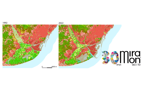
Applications in GIS and remote sensing: We have created land-cover maps, and we study landscape dynamics and ecology, including global change.


