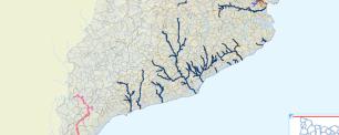
Since 2001, as part of a Systems Plan, the Catalan Water Agency (ACA) is working on the consolidation of a corporative Geographic Information System (GIS).
The responsibilities of the Agency (ACA) have made it necessary to incorporate information from diverse nature, such as from infrastructure projects (supply and sewage networks) and other projects directly related to the environment (watershed boundaries, water bodies, etc.).
GIS also includes information from other corporate information systems, some of them of administrative type, such as databases that include actions on public water, or information systems about the water quality control networks. Another type of integrated information is that from satellite images and their derivatives.
During the implementation it has been necessary to define and create their own infrastructure: software, hardware, storage memory, the structuring of information in a corporate server, the development of tools for easy access and the definition of updating and dissemination flows. This allows the technicians to use all the information related to the land in their usual tasks of water management.


