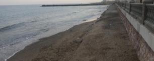
What does it mean that the coast is eroded?
CREAF joins a photographic campaign promoted by the European initiative #Mission4Nature to collect the state of health of the Mediterranean coast. The challenge we set ourselves is to receive a hundred photos of beaches, cliffs, and rocky shores with the hashtag #solvethechallenge, mentioning @creaf_ecologia and @gov4nature and indicating their location. Have you noticed that the beaches have less sand than before, the cliffs collapse and we find rocks everywhere? Well, that's what we want to study! The beaches become narrower and during the storms, entire neighborhoods receive the waves of the sea; It is the impact of a phenomenon known as 'coastal erosion' and we are doing its scientific monitoring. But first of all, we explain this problem in detail.
No space to put the towel
The actual beach goes from the dunes to the sea, passing through the berms, the escarpments, the coastal area, and the sublittoral area.
Beaches are geological systems made up of many different parts and the area where we put the towel is just only a small part. As can be seen in the following figure, the real beach goes from the dunes to the sea, passing through the berms (flat parts or with a little relief, as if they were little mountains), the escarpments (very steep slopes), the coastal zone ( first line of the sea) and the sublittoral zone. However, this photograph of the beach system is not static, it is in continuous movement, and there is a constant flow of sand from the land, from the rivers, marshes and lagoons, towards the sea. This is how the different forms of dunes, berms and etc. are created. between the phases of sand gain (accretion) and loss (erosion) over time.
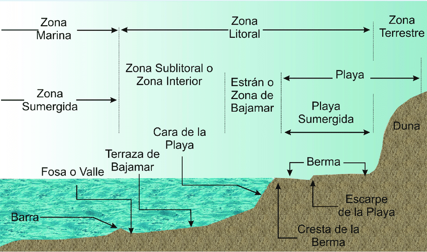
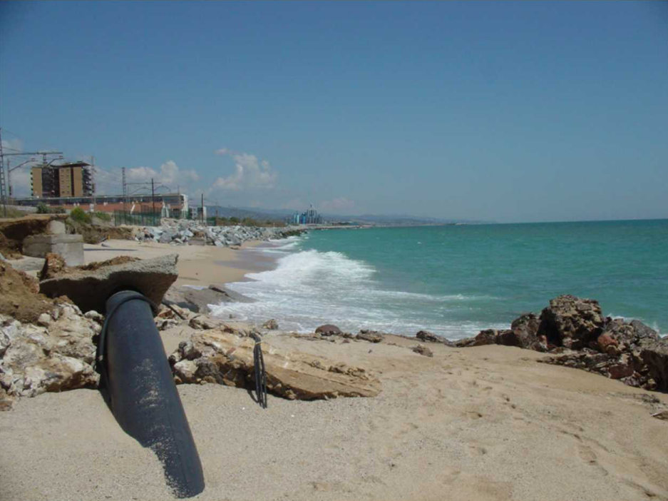
The main problem with this dynamic beach system is that society has planted buildings, breakwaters, ports, promenades and train lines on top of it right down to the coastline.
The main problem with this dynamic beach system is that society has planted buildings, breakwaters, ports, promenades and train lines on top of it right down to the coastline. This has affected the natural dynamics and has changed the movement of the sediments that make up the entire coastline of the territory. In addition, not only the coastal areas have been intervened, but also the flow of rivers and streams, which transport sand from the continent to the sea, is seriously affected. For this reason, now there is no longer only natural erosion as part of the sand accretion-erosion process, but rather a “forced” erosion and an imbalance between the sand gain and loss phases. We can clearly see it in the increasingly narrow beaches, which must constantly receive sand inputs to maintain themselves.
What does all this imply in our day to day? Obviously, coastal erosion not only affects maritime leisure activities and the space where we put our towels, which is being lost rapidly, but we also lose coastal properties - such as flood regulation and the barrier it represents so that the big waves do not reach the buildings– and landmarks of high cultural and tourist value are destroyed. Three well-known cases that are already suffering from this phenomenon are the Salento coast in southern Italy, the Valencian beaches and the entire Maresme coastline.
Nature saves nature
Finding a way to recover the natural movement of sediments on our coasts is a very complex issue. On the one hand, there are various engineering techniques, such as the well-known artificial feeding of the beaches, measures to regenerate the dunes or the stabilization of the cliffs by means of metal nets or steel rings. Some of these methods use natural materials, such as local vegetation, and this is a positive point. However, it must be clear that they do not eradicate the underlying problem, coastal erosion, but rather mitigate its effects and can also have unwanted impacts, as occurs with the regeneration of beaches, which affects the seabed and the species that live on it in her.

"Coast erosion cannot be tackled only through engineering, and even less when it involves intrusive methods such as building dikes, revetments, groynes, etc, but it is necessary to think about recovering nature functioning in the long term".
ANNELIES BROEKMAN, investigadora del CREAF.
According to CREAF researcher Annelies Broekman, “the best solutions are those capable of recovering the dynamics of sediments and those that help beaches to be more resilient in the face of this problem. For this reason, it is important to think carefully about how we plan urban areas, so that coastal areas are not invaded en masse, how we manage rivers and how we design ports, among others”. And he warns that "coastal erosion cannot be tackled only through engineering, and even less when it involves intrusive methods such as building dikes, revetments, groynes, etc., but we must think about recovering the functioning of nature in the long term”. In this line, the Integrated Management of Coastal Zones (GIZC) was born, a protocol to responsibly manage coastal zones and seek a balance between environmental, economic, social, cultural, and recreational objectives.
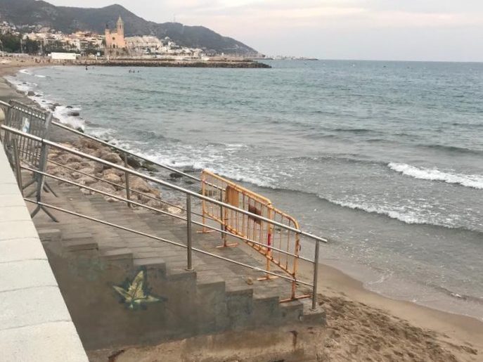
Finally, we cannot forget that this need for management is accentuated by the climate emergency in which we find ourselves,because climate change raises the sea level, changes the winds and waves, and increases the occurrence of droughts, storms, and floods. –phenomena that are common in the Mediterranean, but now occur much more frequently.
Citizens photographing erosion
One last point that is very necessary to protect our coasts is that all citizens must become aware of this problem. We must understand what is happening and the consequences it may have for our day to day, and thus become more involved in decision-making about the future of the coast and its ecosystems.
Send us photos of affected coastlines and their location with the hashtag #resuelveelreto and mentioning @creaf_ecologia and @gov4nature.
Following this objective, the Mission for Natural Heritage (Mission for Natural Heritage in its original name, in English) of the InterregEuroMed Program launches a campaign to collect photographs taken by citizens from coast to coast throughout the Mediterranean, where a worrisome coastal erosion. Under the hashtag #solvethechallenge, mentioning @creaf_ecologia and @gov4nature and indicating the location of the photographed beach, cliff or shoreline, the Mission's researchers and environmental managers will review each image and see if the problem is being understood and which areas are the most affected in the basin.
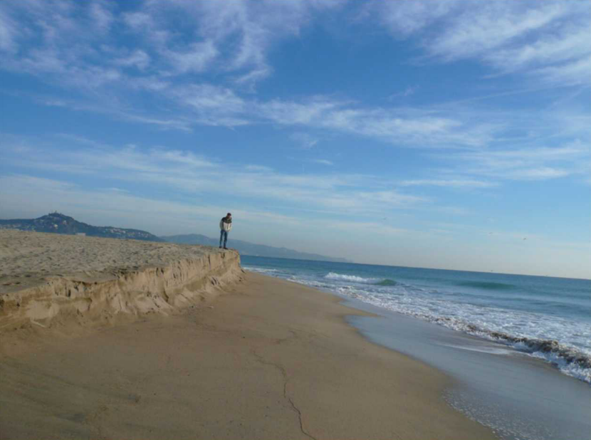
How to identify erosion? In the case of rocky banks, it is considered that the cliff is affected by erosion if large cracks appear in the rock, which it seems that in the future may become caves or arches and end up separating. In the case of sandy beaches, which are somewhat more difficult to identify, signs of erosion include a low volume of sand, a narrower than usual width of the beach, or the size of the dunes. In addition, on the affected beaches it is difficult to find the typical forms of berms, escarpments and/or bars in the interior of the sea.
From CREAF we are involved in the project with the aim of transmitting information from science to the decision-making of the competent administrations; At the same time, we want to stress the importance of involving society in solving the challenges of adapting to global change. Join us and actively participate in this campaign by sharing photos when you observe the phenomena of coastal erosion in the Mediterranean!


