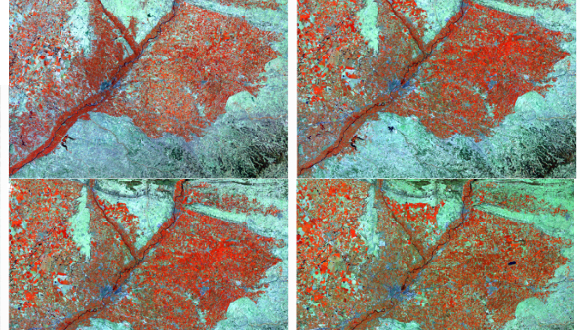
Studying the effects of climate change from space enters the Big Data era
A new method developed by CREAF and the Autonomous University of Barcelona allows the automatic processing of thousands of satellite images taken by Landsat without manual intervention or the need of atmospheric data.

For 40 years Landsat satellites have photographed all Spanish territory every 16 days at a resolution of 30 meters (or every 18 days at a resolution of 60 meters in the case of older photos). These images give insight into how the territory has changed over the last few decades. For analysis, it is necessary that these images be as comparable as possible, achieved by correcting the effects that atmosphere and relief have on illumination. This type of correction is called radiometric correction and to date this has been done using a manual process using an algorithm, and in the hands of an expert approximately one image approximately 30 minutes could be corrected. Now, CREAF and the Autonomous University of Barcelona have published a new method in the International Journal of Applied Earth Observation and Geoinformation that allows the correction of satellite images without manual intervention. “This new method makes it possible that while the machines are correcting non-stop a large series of images, the experts dedicate their time to posterior analyses which are less mechanical and much more interesting,” comments Lluís Pesquer, CREAF researcher and member of the GRUMETS group (CREAF-UAB).
This new method is a change in paradigm because it makes it possible to correct terabytes of images without dedicating many human resources, and as a result, making possible possible projects which before were non-viable.
Additionally, the algorithm developed by CREAF does not need the atmospheric data from the moment in which the image was taken. This gives it an advantage against other correction algorithms which do need this information, and allows it to automatically correct old Landsat images in periods and regions where these data are not available.
Big Data projects for studying global change
Up until now, with the manual method and the limitations of time and resources, projects related to global change or the environment were mostly based in products with less spatial resolution (for example MODIS with 500 meter resolution) or in some cases in a limited number of images, for instance using a reduced selection. “This new correction method allows us to work with volumes of information called Big Data, a new scenario in which our investigative possibilities and work methods are radically changed and amplified,” comments Xavier Pons, professor of the Department of Geography of the UAB and leader of the GRUMETS group (CREAF-UAB). In fact, this new method is already being applied to the DinaClive project with the objective of evaluating, using thousands of satellite images, how land use and cover of the whole Iberian Peninsula have changed over 40 years, what factors have modified the landscape (urbanization, climate change, drought, biological invasions, wildfires, etc.) and the real impacts of climate change on the territory.


