CREAF will coordinate the creation of ENEON, a European network of earth observation
This week saw the first meeting of the ConnectinGEO project, a new European Horizon2020 project coordinated by CREAF that has the objective of coordinating and promoting the use of Earth observation data in Europe. Earth observation data are used for determining the health of the planet from space, using remote sensing technology such as sensors and cameras on planes, satellites, and other airships

To what degree can Earth cope with human activities before suffering irreversible or catastrophic changes? To respond to this question, scientists need to monitor and thoroughly study the state of the Earth, using data that provide us information about its condition and evolution of change. Most of these data are currently found in the global system of systems for Earth observation data called GEOSS (Global Earth Observation System of Systems). This network gathers data and information from many different Earth observation networks worldwide which freely share information about climate, natural resources, raw materials, biodiversity, pollution, etc.
Improving the GEOSS network at the European level is a priority for the European Union, and for this reason the European research program Horizon2020 has granted 1 million euros to a consortium of research centers and businesses helmed by CREAF to develop a research project called ConnectinGEO.
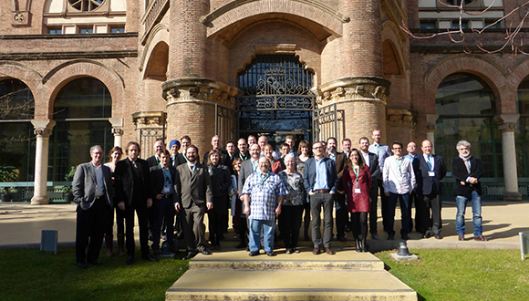
ConnectinGEO began the 18th-19th of February with the first meeting of the international group of partners. The goal of the GEOSS is to procure the best data, and that scientists, managers, and politicians can use them to track the environmental health of European territory. "Only if we have enough data on Europe and if these are of good enough quality will we be able to know if we are achieving the Goals of Sustainable Development being proposed by the United Nations, or if we are about to overshoot planetary boundaries," says Joan Masó, CREAF researcher coordinating the project. To meet this goal, the project needs to assure that Earth observation data in GEOSS cover European territory in a homogenous manner. It will also propose data improvement where necessary, record data quality, and make data available according to a clear and transparent policy.
Studying the health of the planet from space is valuable knowledge
The project ConnectinGEO aims to clearly show the value and utility of Earth observation data. The project team hopes that this information is used and drawn on when making projections and planning sustainable use of the territory and the environment.
The project will create a larger network of sub-networks of European observations to be called ENEON. "If we are able to define well the benefits of being included in ENEON, the initiative will be successful," says Joan Masó.
To achieve this, ENEON will coordinate the detection of priority deficiencies in in-situ or satellite observations undertaken in Europe, and will prioritize the resolution of critical information gaps existing in current Earth observation networks within the European Union. This documentation will be later submitted to the European Commission and other financing agencies. Additionally, models and methods allowing the 'translation' of gathered information to a format useful for science, politics, and industry will be proposed. Prioritization will include research activities necessary for gap-filling: for example, during discussions at the initial project meeting was revealed the issue of the fragility and difficulties of maintaining a fleet of operative sea buoys. Also highlighted was the fact that it is very difficult to obtain socioeconomic data in third-world countries, and that remote observation could be a partial solution.
ConnectinGEO will go forward thanks to a consortium led by CREAF and made up of research centers from the Italian National Council of Research (CNR), the International Institute for Applied Systems Analysis (IIASA), Austria, the Euro-Mediterranean Centro on Climate Change, Italy, the World Meteorological Organization (WMO), Switzerland, the Norwegian Institute for Air Research, the Belgian Institute for Space Aeronomy, the Spanish Council for Scientific Research (CSIC), and the companies S & T Corporation, Holland, 52° North GmbH, Germany, Armin, France, and Tiwah UG, Germany, the European Association of Remote Sensing Companies (EARSC), UK, and the Institute of Electrical and Electronics Engineers France Section (IEEE).
WEB: http://www.connectingeo.net/
Twitter: https://twitter.com/connectingeo


