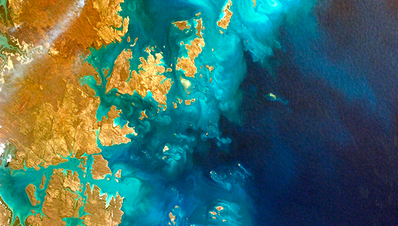
MiraMon is now free to the international education community
This places MiraMon among the first to offer free specific remote sensing software and is now included in the set of free online Geographic Information System (GIS) tools.

After 23 years of constant evolution and improvements, MiraMon aims to take another step forward and become an international leader in its sector. To achieve this, the team and its creator have decided that, starting this September, MiraMon will be free for the education community worldwide: education centres, associated entities and students.
“We took this decision with the aim of increasing the number of users, not only in Spain, but in Europe and around the world”, says Xavier Pons, professor of Geography at the Universitat Autònoma de Barcelona (UAB) and researcher at CREAF, creator of MiraMon.
“With this decision, our pioneering position in remote sensing software with a full integration of GIS continues to be free and we will join the other GIS which also offer their programmes at no cost”, he concludes.
Its robustness, high performance and accuracy, together with the facility of acquiring it for free, has made MiraMon one of the most well-known and used Remote Sensing and Geographic Information Systems (GIS) in Catalonia, where it has gained thousands of users since it was created in 1994, thanks to an agreement with the Government of Catalonia. With this recent decision, the creator of the software and his team aim to obtain similar levels of success in many other countries. Behind MiraMon there is a group of professionals from the CREAF and the UAB with over 20 years of experience in developing GIS, treating satellite images and managing servers, geospatial data portals and big data.
A Tool Designed for Education
Some 200,000 people use MiraMon in 38 different countries. It is worth highlighting its use in several graduate programmes, at the UAB in Catalonia and at the National Distance Education University (UNED) in Spain. Research and secondary education centres, as well as natural parks also use the software.
The free MiraMon Professional offers unique functionalities which are very useful to the education community. First of all because a large portion of its developers are also teachers who are constantly designing and improving the contents in order to maximise its potential as an educational tool. Secondly, and equally important, is its easy installation and management in classrooms and laboratories, given that it depends on no third party configurations or compilations, and has no license validation problems. Its robust structure also behaves in a homogeneous manner in several of the operating systems' platforms and versions.
MiraMon includes a professional development team offering personalised and on-going services via e-mail or telephone.
There are also a multi-language User Forum, a Versions Diary where users are informed about all the new improvements and changes, and there are several beginner and advanced courses users can take to improve their knowledge of the tool.
Tailor-Made for Earth Observation R&D
MiraMon is especially powerful as a remote sensing software, with more features than other GIS softwares. It includes tools especially designed for this objective, such as the correction of the geometry of satellite, aircraft and drones imagery; the correction of the radiometric data (in the solar, thermal, etc. spectrum); platform and sensor normalised metadata (which permits both an easy and accurate use); a joint support for the multiple spectral bands recorded by remote sensing tools; thematic mapping image converters (classifiers), and an advanced generation of diverse statistics with the aim of discovering the quality of products obtained from the viewpoints of producers and end users.
At the same time, it includes a highly complete and specialised metadata manager which contains two tools. Firstly, a MetaData Manager (GeMM) which permits generating, editing and storing metadata and relations with other single layer or cartographic series databases. The GeMM follows the INSPIRE Directive and complies with all standards (ISO 19115, FGDC, etc).
In contrast to other simply documental applications, the GeMM controls the consistency of metadata and confirms its coherence with the data.
Moreover, it also contains an application called Metadata Catalog, designed according to the Core ISO 19115 scheme and elements, which allows creating a customizable web interface to consult the catalogue.
Finally, MiraMon offers the possibility of automating many processes thanks to the design and implementation of algorithms in high performance distributed environments or in multi-core computers (known as parallelisation, allowing a greater amount of data to be treated and which makes MiraMon unique in its sector).
Trial Tool and Development of International Standards
MiraMon is a development and experimentation platform for the main geospatial standards in interoperability (of data, quality and compression and preservation of data).
The MiraMon team works on several European projects focused on international standards and interoperability. It also participates in a large number of international platforms related to this subject.
With the help of the MiraMon open source technology, interoperable visualisation portals can be created, and geoinformation queries and downloads can be done through the internet.


