Earth observation
A cyberinfrastructure for a better use of environmental information
In recent decades, Earth Observation technology has experienced a sharp growth. Observation and monitoring networks generate more and more data and current management systems are getting overloaded with information. As a result, research and decision making are slowed down. The European Open-Earth-Monitor project (OEMC) plans to design a cyberinfrastructure that can easily work with these large volumes of data.
How to improve the EU's drinking water supply by monitoring lakes
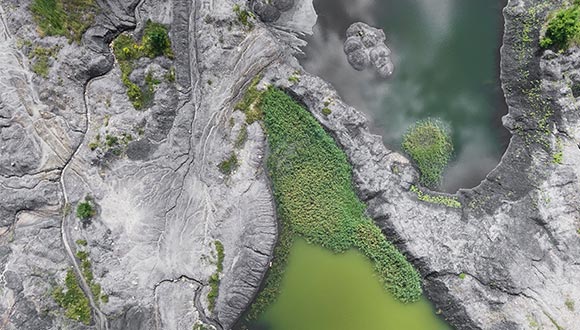
Monitoring the extent of lake effluents provides valuable information on the risk of pollution and contributes to improving drinking water production and preserving environmental sustainability. This is the aim of the European WQeMS project, which seeks to improve the supply of drinking water to all member states of the EU by monitoring the quality of lake water, through Earth observation tools.
CREAF, new member of the European Open Science Cloud, EOSC
The recently formed 'European Open Science Cloud, EOSC’ association incorporates CREAF among its members and other research centers and organizations across Europe.
Citizen science, reinforced thanks to Ground Truth 2.0 and its methodology
Creating and validating a methodology to generate citizen science observatories is the common thread of the European project Ground Truth 2.0, which has worked with 4 observatories in Europe (Belgium, Spain, the Netherlands and Sweden) and 2 in Africa (Kenya and Zambia) in actual operating conditions.
CREAF becomes a GEO Associate
With a view to improving access to and the availability and use of geospatial data, the intergovernmental partnership GEO (Group on Earth Observations) has this year established a GEO Associate membership category for organizations based anywhere in the world and related to such data. CREAF recently became one of the first six GEO Associates.
e-shape: a new project which aims at strengthening the benefits for Europe of GEOSS
Participation of CREAF will be in the showcase about Ecology with a certain continuity of the EcoPotential activities.
Satellites are overestimating vegetation's ability to absorb atmospheric carbon dioxide
According to an article by CREAF researchers Benjamin Stocker and Josep Peñuelas published in Nature Geoscience, drought impact studies based on satellite data do not factor in the effects of soil moisture.
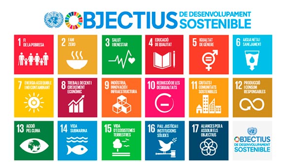
Earth Observation and Essential Variables: useful for evaluating progress towards fulfilment of the Sustainable Development Goals
A CREAF research team comprising Joan Masó, Ivette Serral, Cristina Domingo and Alaitz Zabala has created a graphic that shows the links and gaps between Essential Variables, the Sustainable Development Goal indicators and the data available from Earth observation networks.
ECOPOTENTIAL launched “SPACED: Using Earth Observations to Protect Natural Landscapes" exhibition in Bruxelles
To help promote ECOPOTENTIAL project CREAF and all ECOPOTENTIAL partners opened an exhibition entitled "Spaced: Using Earth Observations to Protect Natural Landscapes" at the European Parliament. Those with passes to the European Parliament can view it from 8-12 January 2018.